Changjiang River (Yangtze River) Geography and Facts
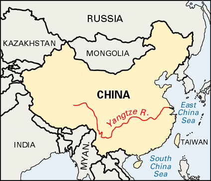
The source of the Yangtze River is the Plateau of Tibet and its mouth is the East China Sea. From source to mouth, on the Left Bank, the Yangtze has 4 principal tributaries- the Yulang, Ming, Jialing, and Han rivers. On the Right Bank, it has 4 principal tributaries as well- the Wu, Yuan, Xiang, and Gan rivers. The Yangtze River serves as a border between 10 regions with a length of 3,915 miles.
Extra Facts-
- The Yangtze River is the longest river in Asia.
- It is the third longest river in the world.
- The length of the Yangtze River is 3,915 miles.
- It is the most important river in China.
- The Yangtze River China's main waterway.
- Its basin is China's granary and almost one-third of the country's population lies in its basin.
- The basin of the Yangtze River extends about 2,000 miles from west to east
- The basin extends more than 600 miles from north to south
- The area of the basin is 698,265 square miles
- Three fourths of Yangtze's course runs through mountains.
- Chang Jiang means "Long River."
- Yangtze is derived from the ancient circle of Yang- name used mainly by those in the West.
